Peep-Sight Alidade: Mapping our World
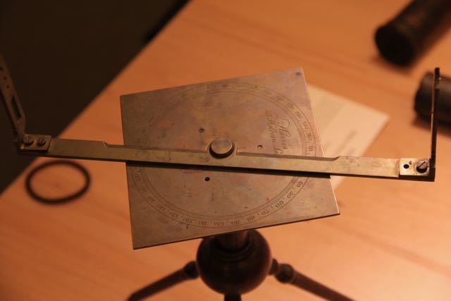
This peep-sight alidade is a relatively simple tool, yet in the era of Middlebury professor Frederick Hall, its ablility to document physical features of the natural world proved valuable in various scientific fields. This alidade also had many practical applications in Hall's education of Middlebury students. Other apparatuses in Hall’s collection, such as his orrery, provided similar scientific and educational benefits.
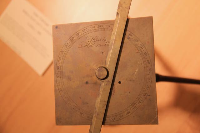
An alidade is a device which can measure the angle between two objects at a distance. Using simple math, these angles can help determine the distance between the two objects. On Hall’s alidade, the angles are ascertained by a scale of degrees finely engraved on the face of a metal plate. The operator simply lines up the sights with the first object, takes note of the angle, rotates the sights to the second object, and then finds the second angle. The difference between these two measurements can then be used for a variety of purposes, most notably in surveying, navigation and map making (Smithsonian).
Hall brought his alidade to Middlebury after college trustees permitted him to go on a two year excursion to Europe. During this trip, Hall attended lectures and universities while also collecting mineral specimens and scientific instruments to add to the college’s resources (“Frederick Hall”). The engraving on the top plate reads “Harris Holborn London”, which indicates the alidade, along with other instruments in Hall’s collection, was made by the English manufacturer, William Harris. Harris owned a workshop on High Holburn Street in London which produced various scientific instruments from 1799 to 1839 (“English-Style”).
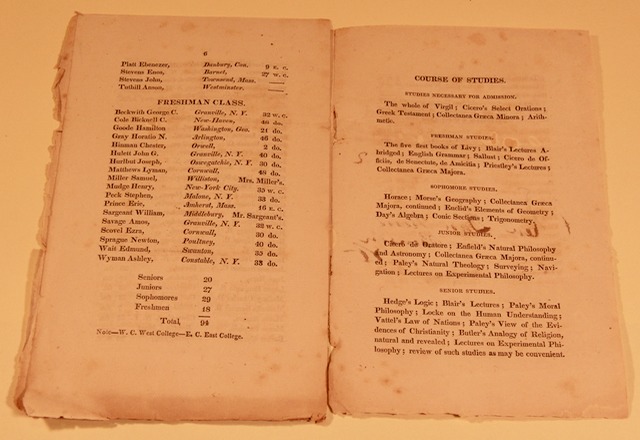
Once in Vermont, Hall’s tools would be instrumental in educating Middlebury students in math and science. An 1818 catalogue of the courses offered at Middlebury lists many classes within the scope of an alidade, such as geometry and trigonometry, as well as some directly related to such an instrument, including surveying and navigation (Middlebury College Course Catalogue 1818). The alidade could serve as a perfect practical example of many topics within the math departments, and would likely be heavily relied upon in navigation related courses. Hall’s alidade certainly had value outside of education as it could provide the scientific community a consistent depiction of the natural world.
The alidade was valuable in developing a sense of the natural world, on both the local and global scale, as it allowed people to document the landscape before them in a precise and accurate way, affording the creation of maps. Paper maps may seem trivial today, yet in Hall’s era, these documents provided more consistent navigation across great distances when compared to using eyesight and judgement alone. Locally, Hall may have used the alidade to create maps of Vermont to augment his scientific documentation of the region, but on a global scale, alidades had an even larger significance in the application of navigation for trading and exploring, a fact demonstrated by the expeditions to the American West made by Edwin James and Henry Schoolcraft, who were both trained by Hall. Following the Middle ages, the desire to navigate for trade was pressing enough to cause an international surge of scientists working to solve various problems within this sector (Principe 2011, 118). Although this movement occurred before Hall, and included instruments other than the alidade, it demonstrates the global importance of being able to accurately navigate, a phenomenon assuredly still in existence in the time of Hall and his instruments. In addition to his Alidade, other apparatuses brought to Vermont by Hall provide similar depictions of the natural world and universe.
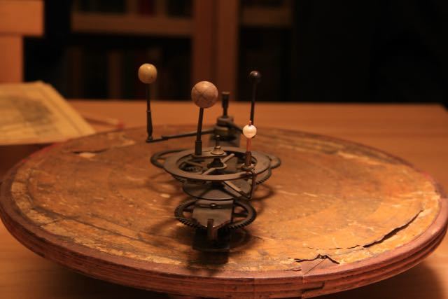
Another object Hall brought back from his journey to Europe was an orrery. The orrery, also manufactured by William Harris, is a moving model of the solar system with a collection of gears orchestrating the planets’ movements so the timing and position of each planet’s revolution around the sun is accurate. The gear system is atop a calendar which allows the relative position of the planets to be discerned at a given time (“Orrery”). The orrery is similar to the alidade in the way it provides a map of our surroundings, but instead of the earth, it maps the solar system. Both instruments gave a more accurate way to plot the position of distant objects than by eyesight and size comparisons alone. The orrery may not have had a practical application in navigation like the alidade, but it undoubtedly had equal value in education for Hall’s students at Middlebury.
Hall’s alidade, along with other instruments in his collection, provided Middlebury students a tool to interpret a unique yet practical aspect of the natural world by creating a visual representation of the spatial relationship between objects and places in the world and beyond. Not only for educating students in Vermont, the alidade was also important in pursuing the global need of navigation, a desire most urgently expressed following the Middle Ages, but still important during Hall’s lifetime. The alidade has applications in many scientific fields, but its use in documenting the earth and its natural features is surely the most significant.
